Training Date: 27, 28 & 29 May 2023
Location: Pashchimanchal Campus, Pokhara, Nepal
Introduction
The End to End UAV Mapping and Image Processing for GIS Data Generation Training Program, organized by Tribhuvan University, Institute of Engineering, Pashchimanchal Campus, Center for Space Science and Geomatics Studies (CSSGS), in collaboration with the University Grants Commission (UGC), aimed to provide participants with comprehensive knowledge and practical skills in the field of UAV mapping and image processing for GIS data generation. The use of Unmanned Aerial Vehicles (UAVs) has surged in the last two decades, making them popular instruments for a wide range of applications, and leading to a remarkable number of scientific contributions in geoscience, remote sensing, and engineering. Construction and infrastructure monitoring, precision farming, and search and rescue in indoor spaces are just some examples of new and emerging applications of UAVs.
Training Objectives
The primary objectives of the training program were as follows:
- To introduce participants to the basics of UAVs and their applications in mapping and data generation.
- To enhance participants' understanding of in-flight operations, autonomous mapping, and drone image processing.
- To provide hands-on training in GIS analysis and report generation using drone-captured data.
- To equip participants with the necessary knowledge and skills to operate drones safely, ethically, and in compliance with air space regulations.
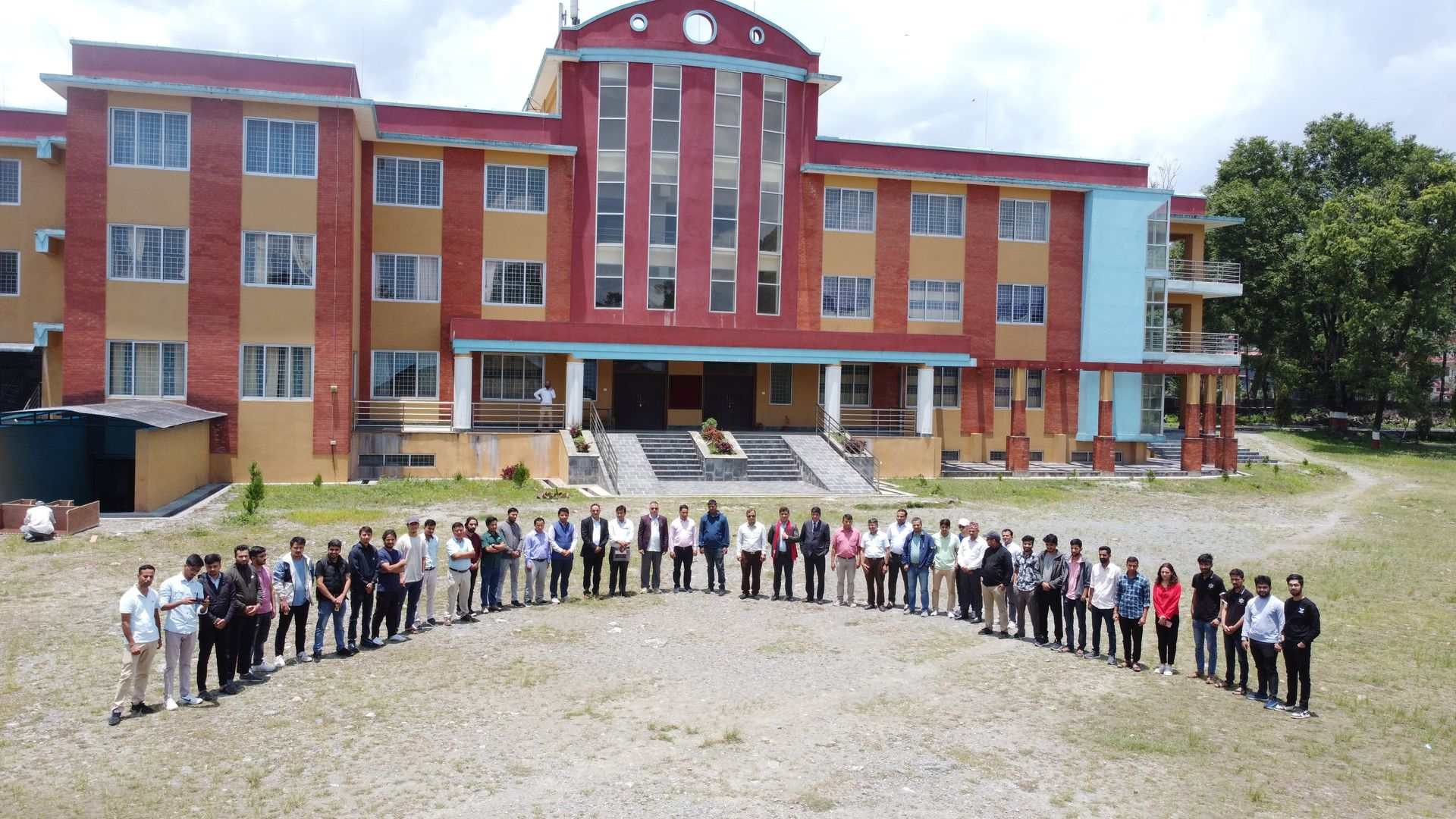
Participants
A total of 40 participants, including faculties and students from various colleges, actively participated in the training program. The participating institutions included:
- Institute of Forestry Pokhara Campus
- Prithvi Narayan Campus
- Institute of Engineering Pashchimanchal Campus
- Pokhara University
Training Modules
The training program consisted of the following modules:
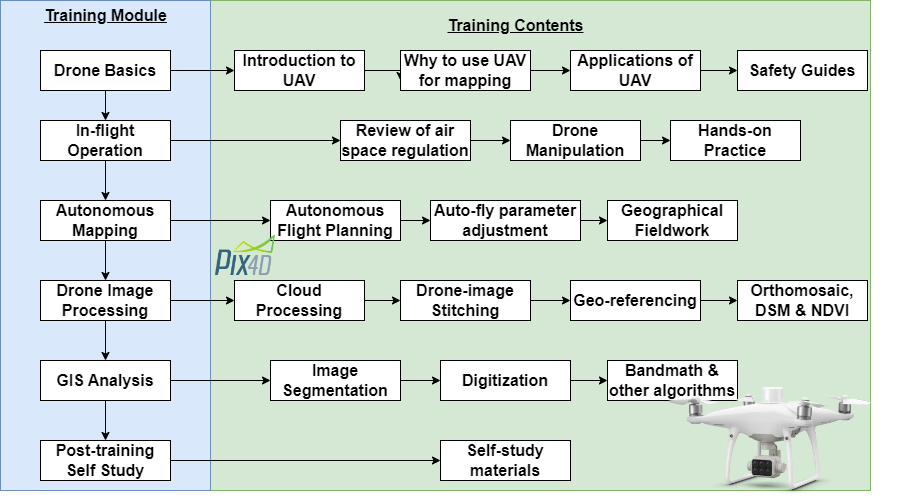
The training sessions covered a wide range of topics, including the fundamentals of UAVs, the importance of UAV mapping, and various applications of drones in different industries. Participants learned about safety guidelines, air space regulations, and best practices for drone manipulation. They were also provided hands-on experience in autonomous flight planning, parameter adjustment, and fieldwork data collection. The training program included practical sessions on drone image processing using software like Esri Drone2Map, Agisoft MetaShape, and PIX4D Cloud. Participants were introduced to GIS analysis techniques such as image segmentation, digitization, and bandmath algorithms. Self-study materials and resources were shared with participants for further learning and exploration.
Trainers
The training program was led by a team of experienced trainers who provided valuable insights and practical knowledge to the participants. The main trainers were:
- Dinesh Mani Bhandari (Co-founder/Research Fellow at Center for Environmental and Sustainable Agricultural Research): With his expertise in UAV mapping and image processing, Mr. Bhandari delivered insightful sessions and hands-on training to the participants.
- Shiva Pokhrel (Co-founder/Research Fellow at Center for Environmental and Sustainable Agricultural Research): Mr. Pokhrel presented on Introduction to UAV, Artificial intelligence (AI), and its Application in Forestry environment and Ecosystem monitoring.
- Nemi Bhattarai (Co-founder/Research Fellow at Center for Environmental and Sustainable Agricultural Research): Mr. Bhattarai conducted an application presentation on Real-Time Human Detection using UAV and Visualization on GIS Platform.
Conclusion and Achievements
The End to End UAV Mapping and Image Processing for GIS Data Generation Training Program concluded successfully, providing participants with a comprehensive understanding of UAV mapping, image processing, and GIS analysis. The hands-on training sessions and practical exercises enabled participants to apply their knowledge and skills in real-world scenarios.
We express our sincere gratitude to Nirmal Prasad Baral (Campus Chief, Institute of Engineering Pashchimanchal Campus), Dr. Krishna Prasad Bhandari (Director, CSSGS), and Bikash Sherchen (HoD, Geomatics Department, IOE, Pashchimanchal Campus) for their support and guidance throughout the training program.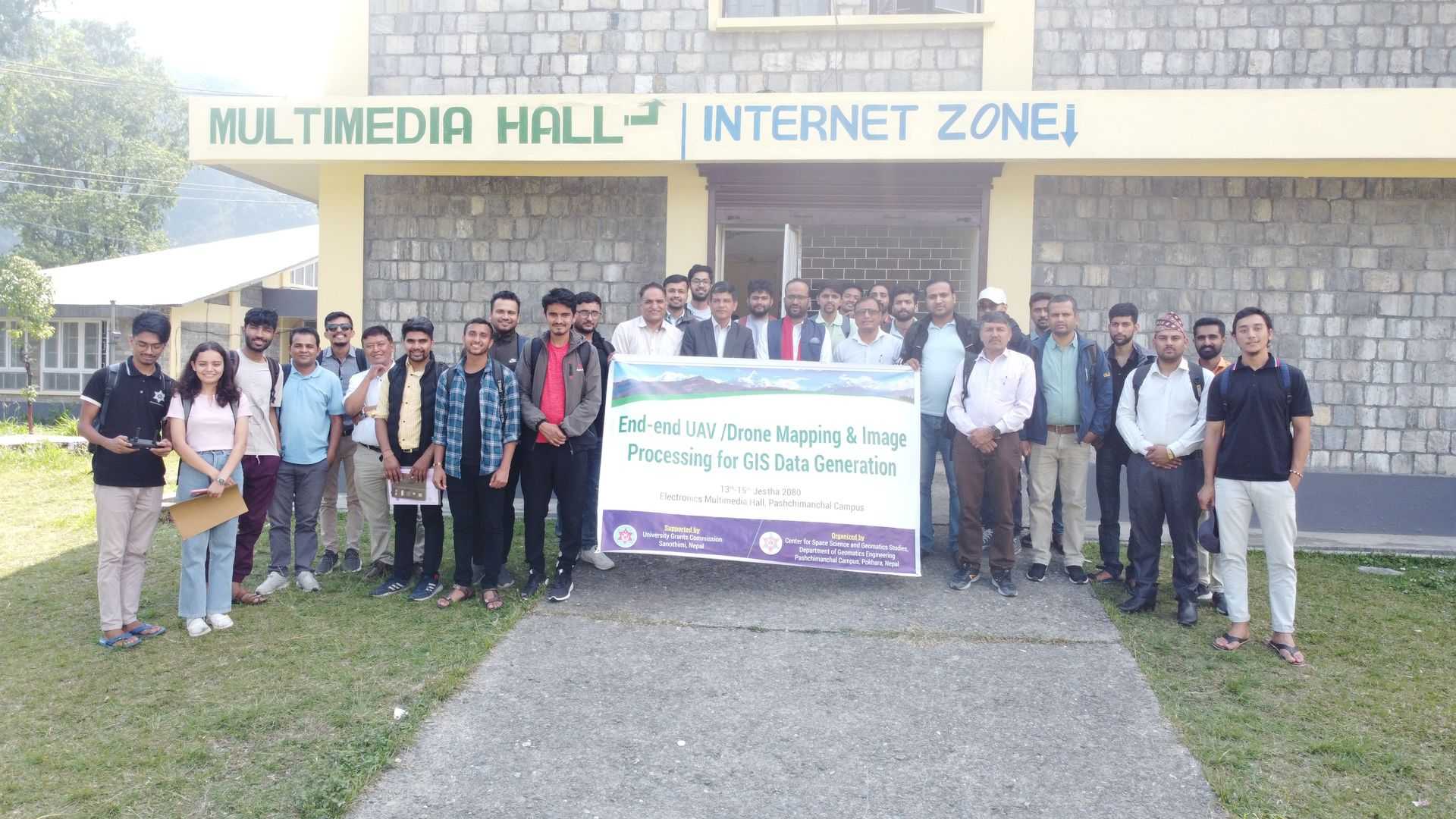
Thank you to all the participants, trainers, and organizers for making this training program a success.
Organized by: Center for Space Science and Geomatics Studies (CSSGS), Tribhuvan University, Institute of Engineering Pashchimanchal Campus
Supported by: University Grants Commission (UGC), Sanothimi, Bhaktapur, Nepal
![]()