At the Center for Environmental and Sustainable Agricultural Research, we are constantly exploring innovative technologies to enhance our research methodologies. One of our recent endeavors involved utilizing the DJI Mavic Air 2 for aerial surveys, a promising tool for capturing high-resolution imagery and generating orthomosaic images. Here, we share our experiences, challenges, and insights from this journey.
The Potential of DJI Mavic Air 2
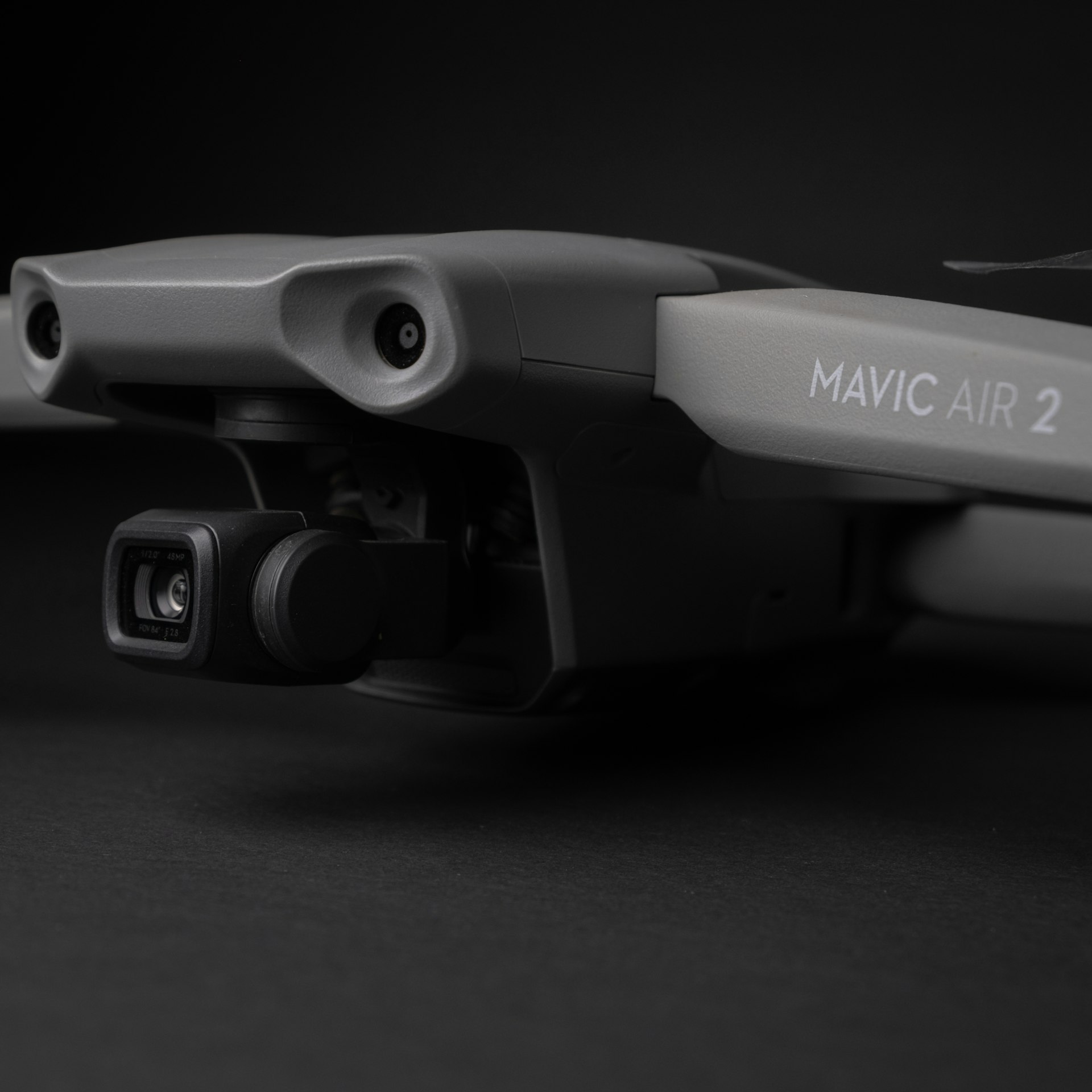
The DJI Mavic Air 2 is a compact yet powerful drone, equipped with a 48MP camera capable of capturing stunningly detailed images. Its portability and advanced imaging capabilities make it an attractive option for environmental and agricultural research. However, our journey with the Mavic Air 2 revealed some limitations and learning curves, particularly when it comes to automated flight planning.
Navigating the Challenges: Manual Flight and Overlapping Images
One of the significant challenges we faced was the absence of a specific app to create automated flight paths for the Mavic Air 2. Automated flight paths are crucial for ensuring consistent image overlap and systematic area coverage, essential for generating accurate orthomosaic images. Without this feature, we had to resort to manual flight.
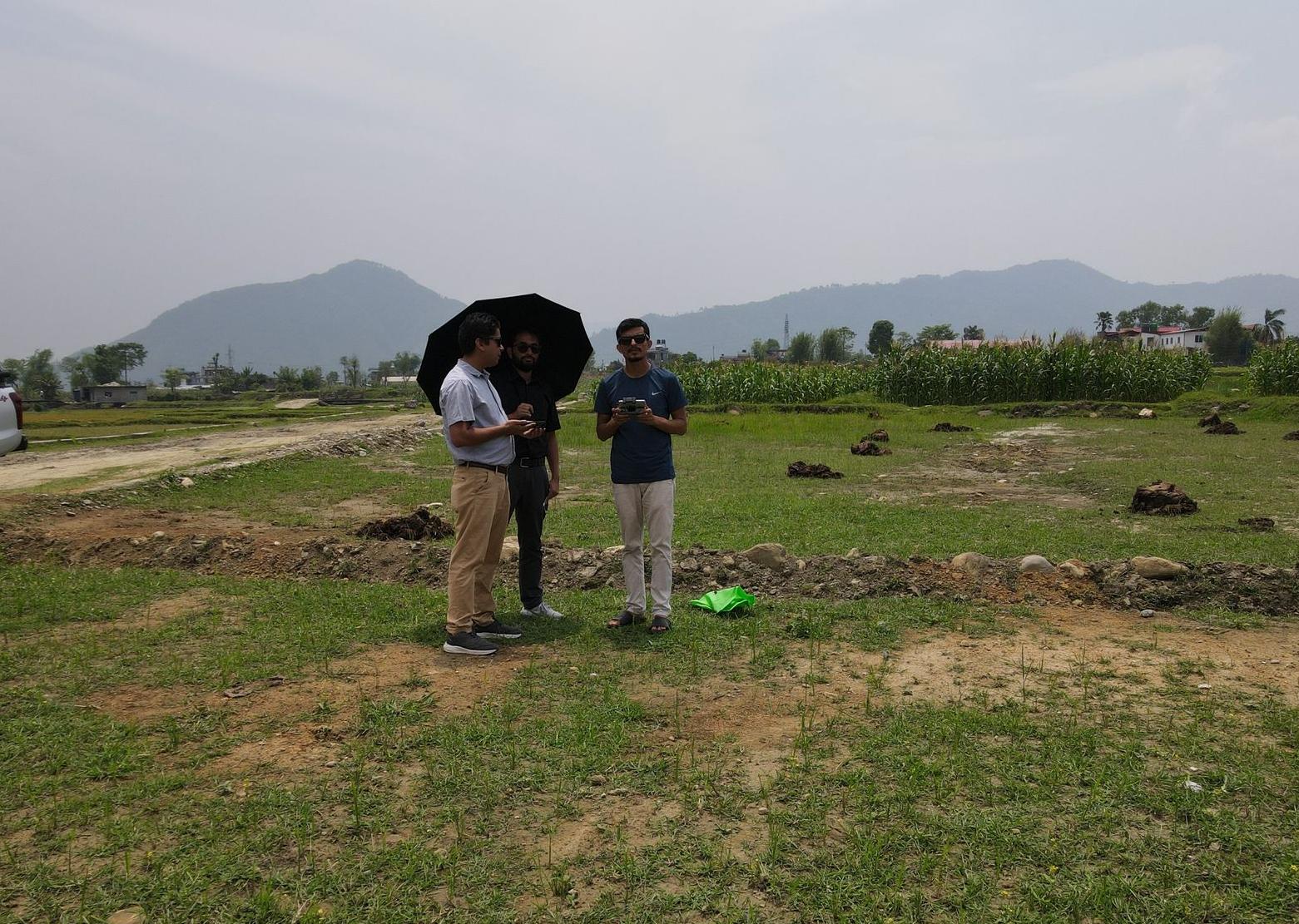
Conducting manual flights required meticulous planning and execution. Our team had to capture numerous overlapping images manually to ensure we had enough data to create a comprehensive orthomosaic image. This process was time-consuming and demanded high precision, as any gaps in the overlap could compromise the quality of the final image.
Exploring Automated Flight Path Solutions
While the lack of a dedicated app for the Mavic Air 2 posed a challenge, we discovered a few enterprise-level apps and software solutions that could facilitate automated flight paths. Notably, DroneDeploy (Flight App) and Maven App offer advanced features for mission planning. Although these solutions are geared towards enterprise use, they provided valuable insights into what is possible with more advanced tools.
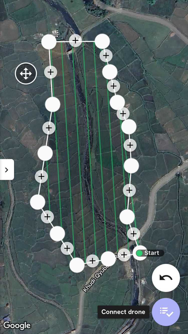
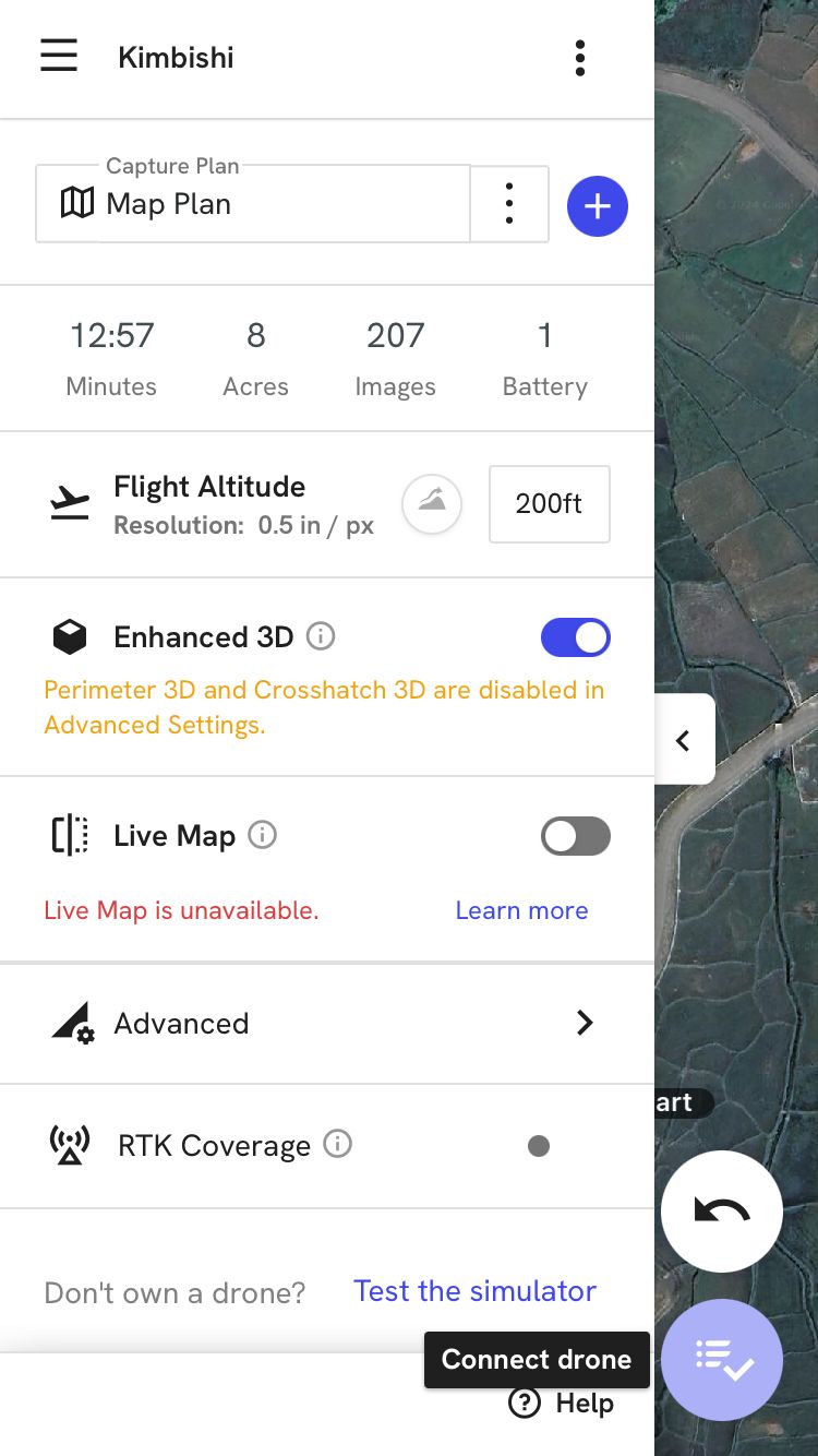
By exploring these options, we gained a better understanding of how automated flight planning can significantly streamline the data collection process. The screenshot above illustrates the automated flight mission planning in the Flight App, showcasing the potential for increased efficiency and accuracy in future surveys.
Processing with Pix4D Cloud
After successfully capturing the necessary images, the next step was processing them to generate the orthomosaic image. For this, we utilized Pix4D Cloud, a powerful photogrammetry software that processes aerial images into high-resolution maps and 3D models.
Survey Details
Total images captured: 156
Average Ground Sampling Distance (GSD): 2.61 cm / 1.03 in
Area Covered: 0.034 km² / 3.3567 ha / 0.01 sq. mi. / 8.2988 acres
The robust processing capabilities of Pix4D Cloud efficiently stitched the images together, creating a detailed and accurate orthomosaic image. Additionally, we generated a sparse Digital Surface Model (DSM) before densification.
 generated with Pix4D Cloud")
The orthomosaic and DSM provided us with a comprehensive view of the surveyed area, highlighting features and patterns that would be challenging to discern from ground-level observations. The final output was a TIFF file, which can be further processed using GIS software like ArcGIS or QGIS for additional analysis and mapping.
Insights and Future Directions
Our experience with the DJI Mavic Air 2 highlighted both the potential and the challenges of using consumer-grade drones for professional research applications. While the manual flight was a significant hurdle, the quality of the images and the resultant orthomosaic demonstrated the drone's capability.
Moving forward, we are eager to see advancements in drone software that could simplify the process of creating automated flight paths for models like the Mavic Air 2. Such developments would undoubtedly enhance the efficiency and accuracy of aerial surveys, making this technology even more accessible and valuable for research purposes.
In the meantime, we remain committed to leveraging the tools at our disposal to advance our understanding of environmental and agricultural systems. The insights gained from aerial surveys with the DJI Mavic Air 2 will undoubtedly contribute to more sustainable and informed decision-making in our field.
Conclusion
The DJI Mavic Air 2 has proven to be a valuable asset in our aerial survey toolkit, despite the challenges posed by manual flight planning. By combining meticulous manual efforts with powerful processing software like Pix4D Cloud, we can generate high-quality orthomosaic images that enhance our research capabilities. As technology evolves, we look forward to even more seamless and efficient survey processes, driving further innovation in environmental and agricultural research.
Stay tuned for more updates and insights from our ongoing projects at the Center for Environmental and Sustainable Agricultural Research. Together, we can explore and harness the power of technology for a sustainable future.